Ground Penetrating Radar Surveys
Discover hidden depths with our Ground Penetrating Radar Surveys. Uncover what lies beneath with accurate subsurface imaging. Enhance your project's success
Revolutionizing GPR Technology.
Our Ground Penetrating Radar (GPR) solutions provide valuable insights for informed decision-making. By revealing what lies beneath the surface, whether it's soil, rock, rubble, pavement, concrete, water, ice, or snow, we unlock endless possibilities. With its versatility, integration with mapping and GPS technology, calibration techniques, and advanced 3D imaging capabilities, GPR can be customized to suit a wide range of applications. Explore the hidden depths with DustcomHDD's cutting-edge GPR technology.
What is Ground Penetrating Radar (GPR)?
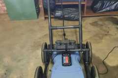
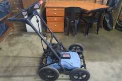
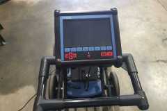
Ground Penetrating Radar, commonly known as GPR, is a non-destructive geophysical technique used to scan and survey underground areas. It operates on the principle of transmitting a short electromagnetic pulse into the ground and recording the reflected energy. The GPR system captures this energy pattern in real time and displays it on a control unit, allowing for on-site interpretation. Additionally, recorded data can be further processed and analyzed using specialized software.
How Does GPR Work?
The working mechanism of GPR involves the transmission and reception of electromagnetic pulses. A transmitter antenna emits a pulse into the ground, and when it encounters a change in the subsurface materials or objects, such as pipes, cables, or reinforcement bars, it reflects back towards the surface. The receiver antenna then captures the reflected energy, which is recorded as a pattern known as radargrams. These radargrams provide valuable insights into the composition and location of underground objects.
At DustcomHDD, we provide our clients with comprehensive reporting options tailored to their specific needs. Our range of services includes:
1. Marks on the Ground
We can mark the locations of buried utilities directly on the ground, giving you a visual reference during excavation.
2. Basic Field Sketch
We offer basic field sketches that outline the positions and depths of underground utilities, providing a quick and clear understanding of the subsurface layout.
3. Full-blown Report (GIS Auto CAD)
For detailed utility mapping, we generate comprehensive reports using GIS (Geographic Information System) and AutoCAD software. These reports provide accurate and precise information, enabling you to make informed decisions for future reference.
GPR Applications for Ground Penetrating Radar Surveys
- Concrete Scanning & Assessment – Locate conduits, post-tension cables, and rebar/reinforcing wire mesh. Assess concrete voids and slab thickness. Detect current-carrying cables and hidden electric cables.
- Utility Locating – Detect and map metallic or plastic utilities, including conduits, voids, gas lines, and power cables.
- Forensic & Law Enforcement – Assist in locating buried evidence for forensic investigations, including bodies, weapons, caches of drugs, and UXO detection. Aid in intrusion monitoring.
- Roads and Bridges – Measure pavement layer thicknesses, assess road structure, and analyze bridge deck deterioration. Provide pavement structure reports and assess asphalt and granular thickness.
- Rail Surveys – Conduct railway structure investigations using the GPR technique. Locate voids, ballast, granular layers, and ballast pockets with a custom-made GPR RRV (Road Railway Vehicle).
- Infrastructure – Locate conduits, post-tension cables, rebar/reinforcing wire mesh, and detect current-carrying cables. Evaluate concrete imaging, post-tension cables, plastic, and metal conduits.
- Mining & Quarrying – Explore hard rock (kimberlites, quarry stone) and sedimentary (potash) formations. Map stratigraphy, detect hazards for mine safety, and aid in mineral exploration.
- Geotechnical & Environmental – Assess faults, sinkholes, bedrock depth, soil stratigraphy, water table delineation, bathymetry, and provide tunneling information. Aid in geotechnical and environmental assessments.
- Archaeological Survey – Utilize GPR for non-intrusive evaluation of historical sites. Locate buried walls, foundations, cemeteries, historic constructions, and precious artifacts.
- Military – Support military operations by detecting buried evidence such as bodies, weapons, caches of drugs, UXO, and intrusion monitoring. Locate cables, sensors embedded in walls, clandestine tunnels, and bunkers.
- Agriculture & Forestry – Assist in checking material alteration or degradation in natural biological materials. Evaluate agriculture, forestry, tree roots, golf green management, agricultural drainage tiles, metal soil water content, wooden poles, trees, underground storage tanks, septic systems, and contaminant delineation/remediation
- Custom Solutions – Develop tailored GPR systems for geology, geophysics, and civil engineering applications. Study landforms, soils, groundwater, and ice formations.
Contact DustcomHDD for professional GPR services and solutions tailored to your specific needs.
Get In Touch With Us!
Have questions or need more information about our services? We are here to help! Contact us using the information below or fill out the form, and our dedicated team will get back to you promptly.


